Click the map for route details
Today the last leg, fittingly almost entirely along the Great River. I arrived in New Orleans, tired from the long journey and became distracted by the city, fatigue, then the bridge
collapse in Minneapolis. As a result, I never wrote about today until just now, when I am already safely back in Minneapolis. I apologize for the delay.
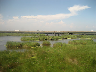
BridgesThe land here is now completely flat, and the few bridges that span the Mississippi rise majestically above the river and present the highest elevations for miles around. The Mississippi River Trail follows the west bank of the river until Edgard, where a ferry crosses into Reserve. Somehow I managed to miss the ferry; it was either poor signage or I was not paying attention. My guess is the former. As a result, I crossed the river not on a ferry, but on the third of the bridges below. It was a major highway, but with a very wide shoulder.
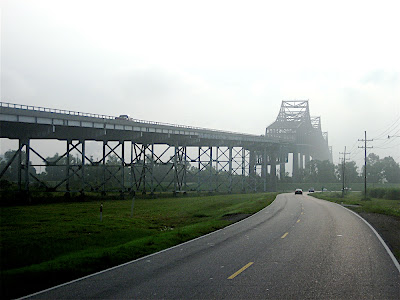 First Mississippi River bridge
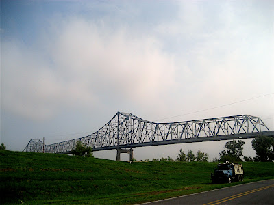 Second Mississippi River bridge
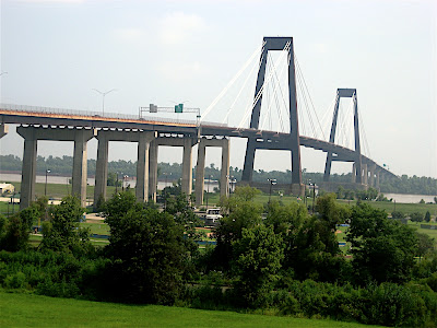 Third Mississippi River bridge
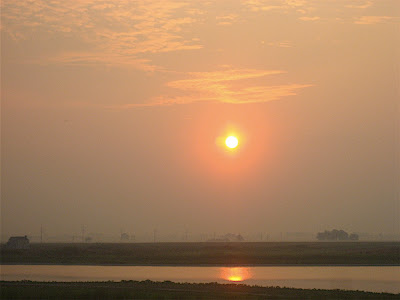
An open shipping channel for even the largest ocean-going ships, plenty of cooling water, cheap land: great for heavy industry. Indeed, the Great River here is dominated by heavy industry, oil, energy, chemicals, and shipping. The day began with a ride past a chemical plant that created a long road of clouds that went on for miles. All I had to do was follow it to reach the next plant.
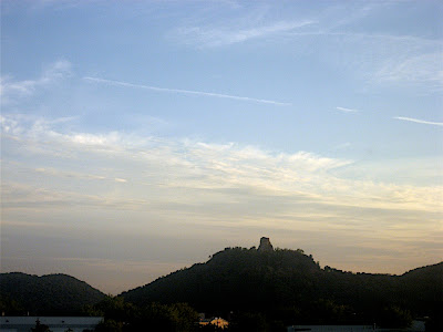
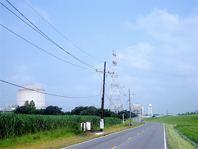
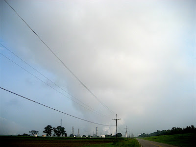 Something in the air this morning
Here, where once the white gold cotton dominated an entire society, oil now reigns supreme. Some cotton fields still remain, but even they are likely to be replaced by corn soon. What are you wearing?
 Black gold replacing the white
The scale of the oil storage tanks here is mind-boggling and almost impossible to capture from the ground with my little camera. Each tank is about the size of a football field, and they are clustered in dozens. Huge pipelines continually cross the River Road, over and under, and serve to unload oil tankers into the tanks. The smell of petrochemicals is always in the air, often accented by sulfur, and the distinct smell of epoxies spices things up from time to time. Nothing like a ride through the fresh air of the open country.
It is not all oil, though. I also rode past a nuclear power plant (which was shut down completely during Hurricane Katrina), and various chemical plants. And the entire ground seems to be completely filled with gas pipelines, which pop up from time to time. Impressive, these bowels of our great civilization—they are what keeps us going.
 Nuclear power plants require lots of cooling water
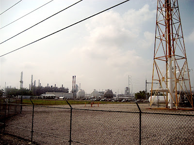 The human element at Dow Chemical Company
The other side of the river was then more dominated by edibles, a separation that I definitely appreciate, even if it may only be symbolic. Here on the east bank, enormous Bunge grain silos line the river. Trains and barges come in from the North, dumping the grains of the greater Midwest into these silos, from where they are in turn dumped into large ships that will carry them all over the world, to the dismay of all the non-subsidized farmers out there.
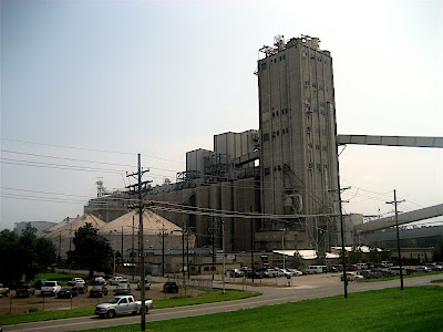 Bunge: where all grain roads converge
It is quite the reverse of what happens at the oil terminals, where the ships are unloaded. I would imagine that the owners of these ships do not want to sail their ships empty, but what do they do? Perhaps they unload their oil near New Orleans, then move up-river to take on grains to bring back home. I am sure that is completely safe if you just hose down the inside of the ships' tanks a bit.
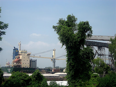 America's grain for the World
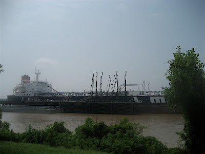 The World's oil for America
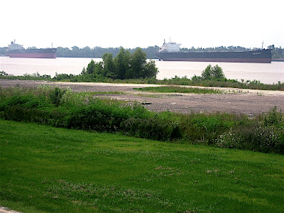 Queuing on the Great River to deliver oil or take on grain
Among all this super-sized industry, the old communities along the way almost get lost. They are, as farther north, typically not much to write home about, although from time to time something catches the eye.
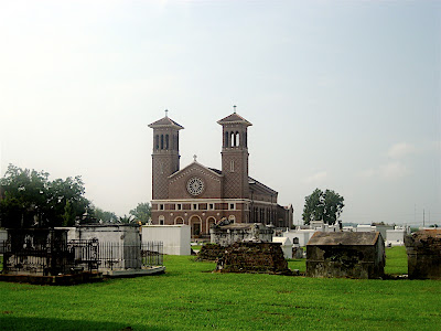 St. John the Baptist catholic church, 1770
This area is also noticeably within the sphere of influence of the Big Easy. Huge and tasteless new mansions are being built, most likely on oil wealth, and always in clusters with high-flying names. You can find them anywhere around America's cities, no need to put up a picture. Another, more subtle change occurs in the people I see. Whereas before today even the young were mostly friendly, they have now turned gangsta, too cool and dangerous for most things, and certainly lycra-clad bikers. And, as in any self-respecting city, even here there are drivers who will take the time to angrily yell at you to "Ride on the f'ing sidewalk!" That gets me every time. Would you ride on this sidewalk, which is exactly where the fat lady suggested I ride?
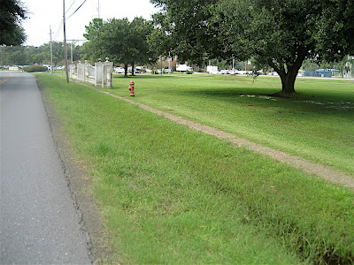 Why not ride on the sidewalk?
Finally, there is still some of the antebellum flair left. The Oak Alley Plantation, for example, was built from 1837-39 by Jacques T. Roman in a Greek revival architectural style and the 28 oak trees in front of it are supposed to be at least 100 years older than the house.
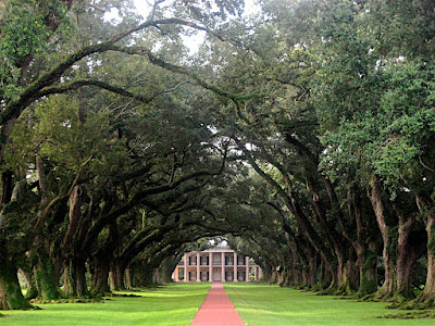 Oak Alley Plantation
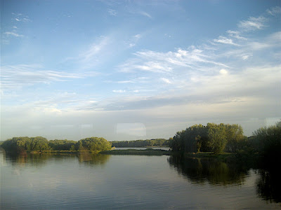
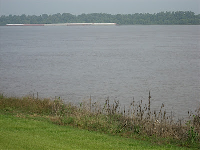 The Mississippi River by the Oak Alley Plantation
And then—finally—the
Big Easy. All the way into New Orleans, the river trail runs atop the levee that protects the city from the Mississippi River. For all the hype about the awesome levees, I have to say that I am not impressed. These are no bigger than any of the dikes you might find along the Weser or Elber rivers in northern Germany. I suppose they get the job done, the threat from the river is apparently not the worst anyway. During Hurricane Katrina, these dikes held up just fine, it was those around
Lake Pontchartrain that failed.
 Ho-hum
The first thing I did upon entering New Orleans was to get lost. Actually, I did this before entering New Orleans because I did not have complete maps and thought myself one riverbend farther down the river than I was. Not to worry, though, a nice tour through the gut-wrenching outskirts that every major American city seems to have. Nothing like mortal fear or being killed dead to revitalize body and mind to finish up a long ride.
Once I found my way back to the levee, I continued on to
Audubon Park, a very nice park in the southwest of the city, adjacent to Tulane and Loyola.
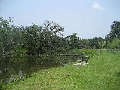 Audubon Park, New Orleans
Then, on my way through the beautiful neighborhood east of the universities and on through much, much poorer quarters towards the eastern parts of the city, it finally happened. The roads of New Orleans had that one pothole too many, and 2276 miles into the trip I broke a spoke in my rear wheel and the tire went flat. Rather than fixing it then and there, I walked the last two miles of my journey. On foot. I am not too proud to admit that while I had biked over a thousand times as far, two miles of walking was all it took to give me a blister. What a finish, just like the legendary (and fictional) race between the two steamers that would determine who would dominate river commerce for years to come. The Illinois, of the established company, won the race, but because their refueling station had been sabotaged, they had to burn the ship's wood to power it, which led to many leaks, and just as the steamer tied up at the dock, wining the race, it sank. But as for me: no matter, the race was finished successfully.
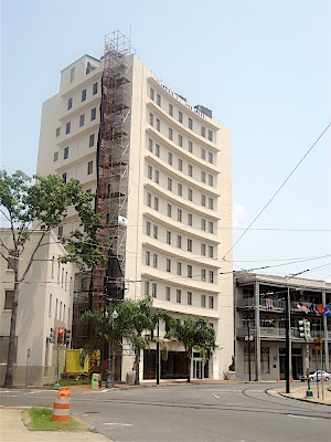 Final destination: Hotel Le Cirque
I can definitely recommend the Hotel Le Cirque, which is very centrally located between
Garden District and
French Quarter, nice, and not at all expensive. Best of all, it provided the most appropriate of all possible final destinations for my trip by offering me a room with a view eye to eye with a larger-than-life
General Robert E. Lee.
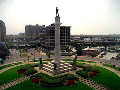 Eye to eye with General Robert E. Lee, almost
From the hotel, I ventured into the French Quarter of New Orleans, but did not have the time, energy, or sole to explore even this part of the city in depth. That shall require a dedicated trip. I did manage to eat some gumbo. After the gumbo, I had some jambalaya. After the jambalaya, I had some red beans and rice. Unfortunately, I was then too full to try any seafood, you cannot have it all.
While I did not spend much time in the French Quarter, New Orleans's main tourist attraction, I think I got a good impression of it. It is one of those rarities in America: a naturally grown, urban neighborhood that is over a hundred years old. Many of the old buildings are beautiful, but as in most places in this country, cars have invaded and completely taken over even this truly historic district. They do not just pollute aesthetically, they are loud, stinky, and impede pedestrians, who in their presence are confined to narrow sidewalks, mere afterthoughts to the infrastructure. This can ruin just about any neighborhood, as it does in the French Quarter.
In addition, as the main tourist attraction, the French Quarter is a money-maker, and money is best made off belligerent drunkards, as the people of New Orleans well know. Bars and nightclubs, interspersed with gift shops that sell cheap Chinese garbage, are the dominant businesses, and annoying frat boys the patrons. And thus the French Quarter's glory is easily lost among those who do not care, even to those who do.
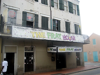 The French Quarter of New Orleans in a nutshell
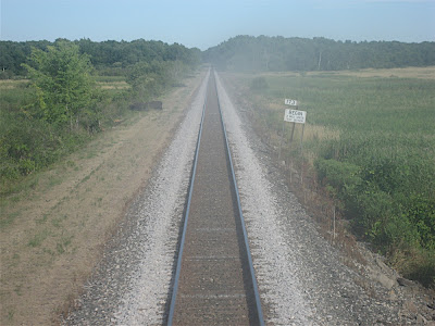
One final river crossing today, dizzyingly high above the Mississippi over an otherwise flat land. To the left, the barges and silos that feed the world.
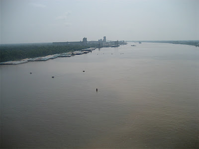 Mississippi River Crossing 29
The final results are in. The racoons have shown everyone how to do it, although their complete dominance naturally leads many to suspect foul play. I do not know anything about that, I just count 'em. Congratulations to the racoons.
 Who's your daddy?
- Raccoon: 90
- Opossum: 65
- Snake: 36
- Frog: 31
- Armadillo: 27
- Skunk: 26
- Squirrel: 21
- Deer: 19
- Cat: 17
- Turtle: 15
- Groundhog: 13
- Bunnywabbit: 10
- Mouse: 7
- Fox: 3
- Lizard: 3
- Dog: 3
- Mole: 2
- Porcupine: 1
- Chipmunk: 1
- Boar: 1
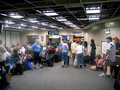
DoneSo there it is. The Mississippi from top to bottom, 2278 miles in 23 days. Compare that to the 2204 miles the Tour de France did in 21 days. I did not see them haul around all their stuff, ride in the wind all day, or sleep in tents, let alone ride on nothing but Little Debbies, double cheeseburgers, and chocolate milk.
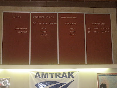
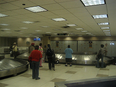
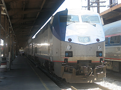
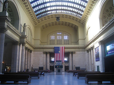
I thank all of you who have been following along these past three weeks. You have been, in a way, my constant companions on this trip. Solitude is fun for a while, but shared solitude even better. I will also report on the Amtrak ride back to Minneapolis, but this concludes the main trip. There is much I meant to mention that escaped my tired mind at the end of many a long day, and I may post more in the future, but if you have had only one percent of the fun reading this that I have had riding it, the mission has been accomplished.
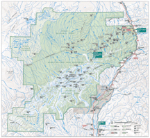 Before I write anything more, let me get this out of the way: Denali National Park is overrated. There, I've said it. It may sound like sacrilege to some, but it's true. Don't get me wrong, it's not that it is not beautiful, breathtaking, humbling, and all of that, but you don't have to go into the National Park (click on the map to the left for a full-size version) to experience all these things. Instead, you could just go back down to Cantwell and take Highway 8, the "Denali Highway" and be just as in the middle of nature as you are in the park. If Mount Denali is what you are after, chances are you will not see it anyway because it makes its own, bad weather. And the only way you can get into the park is inside a very uncomfortable bus, but more on that later.